BMT-AT Loop: Welcome Home, Springer to Davenport Gap
- Brothers Welch
- Nov 2, 2021
- 40 min read
Pt 1 Smokies
Pt 2 The Wilds
Pt 3 The Boarlands
Pt 4 The Frogs
Pt 5 Sprint to Springer
Black Gap Shelter: AT Approach Trail ( Mile 7.3 on Approach)
Our Appalachian Trail leg actually began a bit further back from Springer. We hiked down the approach trail to Black Gap Shelter after visiting the Benton MacKaye monument and the Springer Mountain Southern Terminus plaque.
We got in early and were a bit awe-struck at the vast campgrounds in front of the shelter. So many beautifully spread, flat surfaces spaced to accommodate the vast throngs of thru-hikers that begin their treks on the AT's approach trail in early Spring. Since we were on the AT in the off-season (so to speak) we had this whole vast area to ourselves until a pair of weekend campers showed up later at night. The water source here was flowing well but is a steep, steep down on a blue blaze.
Justus Creek Campsites: Mile 14.3
Black Gap Shelter was also where J-Dub stayed on the first night of his thru-hike and part of our back tracking was us wanting to get a bit touristy with this part of our trip. Rather than just do miles, we wanted to put our trail legs to good use and see some of the historic AT sites in Georgia. For my part, I wanted to stop in at Springer Shelter, another starting point for many thru-hikers, and J-Dub wanted to see the Len Foote Hike Inn a small lodge only accessible by hiking the approach trail (which it's worth noting is no simple feat) and following a side trail to the grounds.
We carried all our food and smellables, but otherwise left our camp to slack-pack the roughly two miles back to the Inn. They were doing a cleaning and repair day so we weren't able to stay there, an initial thought of ours, but they still let us photograph and explore the grounds while volunteers readied the lodge for the next season of visitors. "Day hikers are always welcome," we were told by the director as we asked if it was okay to be around with so much work happening. An incredibly hiker friendly establishment which seems like it'd be a lovely stay!
With that checked off the list we broke camp and began our northward journey on the AT, making a quick pit-stop at the Springer shelter.
Here in the early parts of the AT it was especially apparent what a massive public works project the trail is, a key thought of MacKaye's. The amount of maintenance required, trail work completed, and infrastructure in place to support thousands of hikers every Spring is staggering. The remoteness of the BMT made these features all the more apparent and the AT truly felt like the "hiking highway" some people jokingly call it. That said, much like an actual highway, you still have to drive, or, in our case hike and stay safe.
We had taken a nice long break at Long Creek Falls when we passed it on the BMT, but we still popped in again. We were hitting it closer to lunch this time around so it was more packed with tourists, day hikers, and swimmers. We didn't dally quite as long, but ate some lunch and made our way up Hawk Mountain.
Hawk Mountain Shelter had a few other hikers in it and this was the beginning of our realization that unlike the BMT, we wouldn't be alone and we would have to get use to socializing once again! Many of these hikers were just starting out on LASHes (Long Ass Section Hikes) or late thru-hike attempts so we had a bit more stamina than them at this point in our hike, making it easy enough to politely press on and find somewhere less crowded. We also had a thru-hiker stench going, so I imagine our leaving was greeted with some relief.
Pressing on from Hawk Mountain Shelter we ended our day with a steep climb up Sassafras Mountain and thought we'd be in for it with Justus Mountain but that proved to be pretty tame. We made camp down in the sites by Justus Creek, a long leveled space with some campsites scattered a bit further north too and the Creek as a water source.


Neel Gap: Mile 31.1
We got our typical early start and took breakfast at Gooch Mountain Shelter where we first met Two Liter, then known only as Bob.
We rolled in looking, well, like we had been through it and found a mild mannered older man in a softball shirt eating his breakfast, "You guys are up early," he said cordially. And between privy trips, water runs, and finally settling down to eat we learned that he had come down from the Adirondacks to hike from Amicalola Falls to Fontana.
We were eating oatmeal which was getting difficult to stomach after weeks and weeks of it, so I'm sure we caused quite the goofy little scene griping while simultaneously devouring mushy bags of super greens, oats, and chocolate protein powder. He seemed unbothered by it, so we instantly took a liking to him. He left a little before us and we stayed a bit longer to deal with the rest of our oat concoctions.
We pressed along and thought we might pass Bob, but by the time we stopped to snack at the picnic tables at Woody Gap we still hadn't caught him. He was moving at a good clip!
As we began our climb out of Woody Gap we bumped into an older hiker named Billy who was finishing up a Southbound hike from Erwin, Tennessee. He told us all about the upcoming hostels and stops and was a wealth of information. He especially raved about Neels Gap which was where we were thinking of stopping. As he spoke, Billy made small motions and indicated directions with a tall, gnarled walking stick he used. The white hair, white beard, and old school, long sleeved wool hiking clothes he wore definitely gave him a wizard vibe. He was one of those characters you only meet on the Appalachian Trail who might in fact have a kind of magic about them.
Billy told us about a campsite shortly up trail from Neel Gap that would let us wake right up and head to the outfitters there. He also mentioned a water spigot and outlet to charge our phones on the exterior of the outfitters before we headed to said site.
Leaving Billy, we pressed on, stopping along at all the little view points and outlooks on the trail. Along with the obvious infrastructure of the trail, the AT also stood out to us as more of a sightseeing trail. The trail purposefully stays on the ridges of mountain ranges and along those ridge walks hikers have ample lookouts and vistas like pull-offs on a scenic byway. We bumped into some hikers who complained about the lack of views in Georgia which we found funny, but it's all about perspective I suppose.
A little ways after filling up our water at Lance Creek to begin the walk up the ridge to Blood Mountain we caught up with Bob.
When we last left him at Gooch Mountain Shelter he had been planning to stop at one of the shelters in between there and Blood Mountain, but now, "I'm thinking about pushing to Neel Gap and just having my wife meet me." This was a huge addition of mileage!
"Neel Gap! We'll push to Neel Gap with you!" J-Dub excitedly announced. It was set like a spell. We were all pushing up and over Blood Mountain to Neel Gap.
Blood Mountain, as the name may suggest, is no joke. At 4,458 feet it's the tallest mountain in the Georgia section of the Appalachian Trail. According to the Georgia Historical Commission it's name comes from a battle fought between the Cherokee and Creek in the gap (pleasantly called "Slaughter Gap") at the mountain's base. The height and history compounded with the fact that this was a Summer afternoon in the south with a storm brewing meant that of course this would be an epic hike.
We stopped for water at Slaughter Creek, which runs down into Slaughter Gap, and waited a bit for Bob to catch up with us so we could make the summit as a bit more of a crew. While we waited we met Tom, another older man who was out hiking some of the side trails breaking off from the AT through the Chattahoochee National Forest. We talked with him a bit and he pointed out Whitley Gap Shelter to us on J-Dubs map in the upcoming Raven Cliffs Wilderness Area. It's 1.2 off trail, but (according to Tom) is well worth it.
As Bob caught up Tom teased us about the summit a bit, "Well, are you guys gonna do it?"
Indeed we were.
As we summited, clouds which had been forming all day began clustering around the peak of Blood Mountain, packing together with the low roars of a storm. At over four-thousand feet we were summiting into a thunderhead. Now, reader, while we were technically in tree line, I certainly wouldn't recommend trying this at home... though I will also say it an awesome experience in the true sense of the word: awe-inspiring.
J-Dub likened it to being caught in an old cannon battle. The cloud thickened up the trail so that it was difficult to see very far ahead in the mist and gray. There was a kind of personal quiet filled with our own heavy breathing and beyond that a constant, rumbling din with loud, close blasts breaking the air every now again. The adrenaline of the moment led us quickly up the slick rock to Blood Mountain Shelter, a fully enclosed stone structure built by the Civilian Conservation Corps (CCC) in 1937.
Bob arrived shortly after us and the three of us waited out the brunt of the storm and rain inside the shelter. As we chatted, we learned that Bob was a farmer and had been all his life which explained quite a bit about his prowess on the trail. So much of this distance hiking is mental and the work ethic and focus of a farmer definitely gave him an edge. We had no doubt he'd make it to Fontana and neither did he.
Once the storm passed we began the slow, slick descent off Blood Mountain and were rewarded with spectacular views on the exposed rock faces. While the storm had cleared off the peak, it had splintered into smaller storms, getting trapped as gray-white clumps in the dark, summer green valleys below us.
We hiked down into one of those trapped storms, but by the time we reached Neel Gap all that remained was the mist.
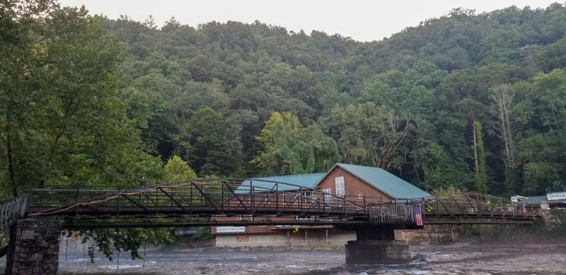
The building at Neel Gap itself, the Walasi-yi Interpretive Center, is another old, stone structure built in 1937 by the CCC. It's been the home of Mountain Crossings since the 1980s, an outfitters that has been a pivotal part of the AT community and a famous shakedown site for northbound thru-hikers. A shakedown being an assessment of all the gears and niceties one brings to determine what's really needs and what's simply extra weight.
In the misty evening we were greeted by the sound of wind chimes gently ringing, a magical, ethereal end to a dramatic summit. We caught a glimpse down the valley from the view at the picnic area before the clouds really closed in.
Bob came in shortly after us and since the spigot out front didn't have any running water he and his wife ran to their AirBnB and filled up our bottles for us. It was an incredibly kind gesture! On any big trail, hikers form "bubbles" of all different sizes. It refers to the hikers that are in your immediate area, a shelter away, a day away, etc. J-Dub and I were glad to have Bob in our little bubble.
As we ate dinner at the picnic area with the space to ourselves and the chimes still gently ringing, we realized the spigot and outlet Billy had mentioned were, in fact, in that picnic area. A good sign since we had kind of been banking on his intel for our campsite as well. By the time we finished eating we were all clouded in. Slowly, we found the trail and picked our way ahead to find the campsite Billy had mentioned, making quick work of our set-up for some much deserved sleep.


Low Gap Shelter: Mile 42.6
Waking up early we headed back to the picnic area to make breakfast, waiting for Mountain Crossings to open at 9:00.
J-Dub had left briefly take a visit to the porta-potties they had set up while the bathrooms weren't open, leaving me admiring the morning view. As I had my coffee water boiling Bill, "just Bill," an older man with a peaceful, soft-spoken manner who managed the store came up and introduced himself after taking his morning walk into the Raven Cliff Wilderness which bordered the shop and hostel.
"Welcome home," he told after a long pause in our conversation when we were both entranced by the view. Then, "I'm going to be starting coffee soon, you can come on in and get some when you're ready."
This set the tone for what would be an incredible experience. This wasn't just a hiker friendly place, it was a place steeped in hiking culture and, specifically, Appalachian Trail culture. There were historical markers documenting and time-lining out the conception and construction of the trail, packs, boots, and photos were hanging in celebration from hikers both legendary and infamous to folks who simply came through, and Bill and Jake, a younger employee we met soon after in the morning, opened up the shop to us as a kind of home, making sure we had everything we needed.
The hostel section of outfitters was still closed because of COVID-19, but the shower rooms and laundry rooms were open so we got two showers (with towels) and a load of laundry done all for $24. Bob came in the late morning and pushed along after taking a look at the view point and getting a photo there of him and his wife courtesy of J-Dub.
Along with a quick clean-up, we resupplied some snacks, posted Sprint to Springer our final BMT section blog and ate pizzas. For $7 we bought and baked frozen pizzas, Bill brought them out to us on their card boxes and we devoured them. There are few culinary experiences fun or satisfying as having your hiker hunger going and facing an entire Tony's pizza as you look out over a vista.


Finally, it was time for us to make some miles. "You guys are still here?" Bill poked as we were packing up in the picnic area. There was a lot of jovial, competitive, old-AT energy around us in Georgia and honestly, it was really refreshing after having to muscle through much of the BMT without other hikers around.
As we headed into the Raven Cliff Wilderness and chatted a bit J-Dub told me that Bill had told him, "Welcome home," when they had a moment to talk one-on-one.
"Yeah! He told me that too!" I excitedly added, as if we had both received some secret communique.
I was so excited because there was a hominess to the AT. The BMT took us through a lot of other outdoors and adventure sports and folks were really respectful and interested in our hike, especially when we were hiking trails they knew from hunting or fording streams where they'd fish. But there wasn't as robust a hiking community or culture (yet) like there is on the Appalachian Trail, and being a part of that again was refreshing and a definite morale boost to complete the loop.
I had high hopes for the Raven Cliff Wilderness, mainly because I thought the name was cool. The portion the AT goes through was a pleasant ridge walk. Nothing too dramatic though. The Raven Cliff Wilderness was also, admittedly, a bit overgrown in parts and would mark the start of some brushy, wilderness areas on the AT. The difference being that the trail itself was so trodden down that it remained easy to find and follow and the brush itself might creep and lean over, but the soil was so compacted by foot traffic that the plants couldn't get a hold into the trail itself and so the stretches of brush were never too, too long.
We passed Bob who was planning to just go until he found a spot to camp. We weren't really sure where we were going either, but eventually decided to settle into Low Gap shelter and tent at one of the plentiful campsites in the area. The shelter itself was a short walk down from our front site, but the water was a nice piped source steps from the shelter itself. There was also an old set of bear cables... but more on that tomorrow


Tray Mountain Shelter: Mile 58.0
A critter got my food bag! I suspect a squirrel. Rough way to start the day. I heard an owl give a combative screech in the night, mainly because a drunk camper in another site made it difficult to sleep, and wonder if I had some avian assistance since the damage wasn't actually too bad, just a few tears and some lost trail mix.
We also didn't get great sleep because of the aforementioned drunk guy so we had a slow, groggy start out of camp. The popularity of the AT compared to other trails, especially wilderness trails like the BMT, means that all kinds of people come out for all different reasons. In the case of our camp buddy, I had bumped into him down by the water where he just started spilling his guts to me about his recent divorce. The trail is here for all kinds of journeys and short of someone being purposefully destructive or harmful, I try to remain empathic... but I also like sleep.
Pretty early day in the day we crossed paths with Bob. He camped a little ways ahead at a nice tent spot with a small stream just down trail. J-Dub and I had been mulling over a trail name for him, but hadn't landed on one yet. He had suggested Tortoise, which was fitting since we had a pretty Tortoise and Hare experience with us kind of goofing around or taking long breaks and him getting just a bit ahead. But Tortoise sounded a bit to serious to us. Back at Neel Gap his wife suggested "poles" since he was hiking with an old pair of ski poles rather than a more traditional wooden staff or contemporary trekking poles. But honestly, ski poles aren't too different from trekking poles, so we liked the name, but wanted to find something a bit more specific to his hike.
He had been hiking with a squeeze filter attached two-liter soda bottle, rather than a manufacturer bag or a trendy smart water bottle. And the two liter was always a noticeable attachment to his pack since it had to be tied on. In this conversation we played around with the idea of "Two-Liter" as a name, but didn't commit, just yet.
On we went toward Unicoi Gap, but first we had to go up and over Blue Mountain. Blue Mountain Shelter itself was a pretty nice spot with a short spur trail to a view and plenty of nice tenting spots. We only stopped for a snack, but would recommend it as a stay. We had gotten water just before it, so can't speak to the source, but I'm sure it's good like most AT shelters.
Down at Unicoi Gap we decided to hitch into Helen, Georgia. I was curious to see it since J-Dub had described it as a German town. I was intrigued and also excited to eat pretzels, brauts, and the full range of German desserts.


It took us a bit to catch a ride, but eventually a driver in an old Prius pointed to double-check we were going his way. After we gave him a big thumbs up he pulled into the parking lot. "Y'all don't mind riding in a Prius do you?" he asked rolling down the window and it was difficult to tell if he was being serious or sarcastic, but with a laugh I said no as J-Dub was gathering up his pack.
We filled up his car and he backed out of the busy mountain pull-off as if it was his own suburban driveway. As we cruised down the curved mountain road, we came to learn that he worked security at a bar in Helen, "It used to be a drinking town, but shifted direction and brought in a lot more attractions, so it's more of a family town now."
He was also a volunteer first-responder for the area's search and rescue, regaling us with some stories and warnings, especially about boar. We were heading back into Boarland, just a few miles East, though it seemed they were just as big a problem here. "Boar'll rake you," he warned, "they're more dangerous than bear, they'll get you down and just rake their tusks back and forth over you." A pretty cheery warning, learning once again that the only thing to do is climb as high as you can if one sees you and charges.
As we drove, he had to pull over to respond to an emergency alert. For a moment, J-Dub and I weren't sure if we were about to get recruited for a carry out since it was for a hiker who had taken a fall and received some head trauma. Apparently the alerts the responders get also include the health of the individual or if companions report a cough or temperature.
"I can't respond to any of the Covid stuff," he told me, turning to meet my gaze in the passenger seat with a new kind of gravitas. While it was clear he had something serious to get off his chest a part of me wished he was looking at the road as it bent and curved around drops, "I have two young grandchildren my wife and I are raising and I can't risk bringing anything back. They're my whole world." I noticed that whenever I told folks that J-Dub and I are brothers, a kind of openness grows in them and soon the conversation shifts from food recommendations to vulnerable reflections on family.
"I just think it's cool as hell you two do this every year." He said as a final comment on family as the little, teal Prius made it's way down the main strip of Helen. He dropped us off at the bar where his shift was starting, a massive space right in the center of town.
I hadn't totally understood what I was getting into. When J-Dub described Helen as a German town, I thought he meant German inspired. In the way that neighborhoods in New York have their own distinct character and immigrant backgrounds, but are still distinctly a normal city. This was like walking into a Disney village. Carriages hitched with Clydesdales pranced down the main street as tourists gazed off the porches and balconies of restaurants with either Alpine or Tudor inspired exteriors.
The restaurant we were recommended and had initially wanted to go eat at was closed, so we settled for another recommendation given us by our Prius driving friend. Our appetite satiated by pretzels and brauts (beyond braut for J-Dub) we took a quick tour, then resupplied. The real show stopper of this pitstop though were the baked goods we got at Hofer's Bakery and Cafe.
Now we were tasked with the challenge of getting out of the town. Like most of our trip, Helen had it's own vibrant tubing scene with the Chattahoochee River running right through it. All along the BMT I had thought that our best chance catching a ride would be from a tubing bus making it's return trip. I'm happy to say that on our way out of Helen, I was able to manifest exactly that. While we could only catch it back to one of the put-in's up river, it still took out a few miles and was definitely one of the coolest hitches I've managed. The driver knew about the BMT too. He'd hiked 100 miles of it before having to get off because one of his hiking party got injured. A bit of BMT magic along the AT.
We still had about 9 miles of road left between us and the road head. It was hot and looking pretty bleak as we trudged along the shoulder, but after awhile a big white truck pulled over with a Georgia Appalachian Trail Club sticker on it, a sight for sore eyes, for sure. We hopped in the bed of the truck and off we went. The road narrowed quite a bit and the curves we went down in the Prius looked much tighter from the bed of the truck, so I was thankful we didn't have to be out walking on them.
"What the hell were you guys thinking? You going to walk the road?" The driver said in greeting as he got out and walked to open the bed.
"Uhh, yeah, I guess," J-Dub said, as the driver, an older man, laughed and shook his head. He introduced himself with his trail name Coop, a two-time AT thru-hiker who prided himself on being a, "Professional Hitchhiker" and told us a few stories about his hitches back in the day as we organized our packs.
We began our ascent up to Tray Mountain shelter which, after our break in town, wasn't so bad. It also rained in the mountains while we were down eating German food, so we had fortunately missed getting wet, but benefited from the cool down. We rolled into the shelter a bit later than usual, but still before sunset. Bob was nowhere to be found, meaning he had pressed on just a little bit further in true tortoise, or should I say Two-Liter, fashion. We had brought up some town food including an apple strudel from the bakery so we set up camp at an inspired speed in one of the plentiful tent sites in the area. Then I made the trek down to the spring box for water and finally we settled in and enjoyed our feast.


Bly Gap: Mile 78
Twenty mile push to Bly Gap and into North Carolina today. The border felt too close not to get too, plus sometimes it's fun doing hard things! There were some steep ups right in the morning, including Kelly Knob, which we were later told is the 7th highest mountain in Georgia.
We passed by Bob and conferred on him the name Two-Liter, he took the name with a laugh, "I thought you guys might have been thinking that," he said in reference to our last conversation. We told him we were pushing to Bly Gap today and he had plans to meet up with his wife at a road crossing a bit before that, so we said our goodbyes thinking this would be our last time crossing paths.
The rest of the day passed by pretty smoothly. We made our way down Dicks Creek Gap and took a little lunch break at the picnic area there. Then began the ridged ups and downs that led to the border. J-Dub got a rough bee sting on the Achilles along the way, the same spot he got back in the Smokies, but the trek was otherwise difficult and uneventful. We pulled into Bly Gap's camping area as a storm did too and we rushed to set up before the rain.
It was a beautiful spot with a great water source we shared with only one other camper. The storm was having a hard time breaking over the ridge so looking back south, one half of the ridge was covered in thick gray, while the other was just pock-marked with a few clouds but remained mainly blue. There was also a gnarled tree covered in mist from the storm. A welcome entry into North Carolina.


Betty Creek Gap: Mile 97
Wet start out of Bly Gap. The storm that had been dramatically cut along the ridge finally composed itself and came on over, bringing a good amount of wind and rain with it throughout the night.
We had Standing Indian as our first big climb of the day and stopped to breakfast, water-up, and prep for it at Muskrat Creek Shelter. The storm last night also got us brainstorming about Tropical Storm Fred which had been brewing for a few days now. We first heard about it from a mason doing some repairs to the stone steps at Neel Gap, he warned us that the projection had the storm coming right up the mountains. Since getting that news we had been keeping an eye and checking updates whenever we had service. As of the most recent projection we had about a day or two before it'd hit, so we decided to get as close to Franklin, NC as we could and get off there.
But first, Standing Indian. The climb turned out to be, not too bad for us honestly. Roughly 400 miles in now, our trail legs were going strong and made quick work of the switchbacked ascent. The ridge was way overgrown, probably our thickest brush stretch on the AT. Covered in Sassafras it was also covered in bees and pollinators collecting some late summer fuel. The bugs were mainly bumble bees who, true to name, just sort of bumbled around frustrated and flustered after we brushed by. Though with J-Dub's sting still fresh, we were a bit wary.
We planned to stop at Carter Gap Shelter to assess the weather if there was service and make a more concrete plan. We didn't know if we wanted to get up Albert Mountain this afternoon, especially with the constant threat of afternoon thunderstorms.
At the shelter we met a hiker from Florida out for a section hike, but a bit discouraged after having his friends bail and getting stuck out in the rain and storms. He was planning to zero at the shelter, then cut down some forest service roads to connect to country roads and get out at a gas station. It was admittedly a pretty savvy plan, and J-Dub and I tried to motivate him to push with us after we chatted and snacked because if he had the navigational skills to organize that out, there was no reason he couldn't push on besides the mental block of feeling down. Ultimately, we couldn't get him up and moving, so we pressed on and wished him luck with his exit.
As we made our way towards Albert we continued weighing our options about Tropical Storm Fred. When friends ask me about the hardest parts of hikes like these, I tell them it's mental and I really mean it. Whether it's the mental break of pushing through the first 2 weeks of being just generally wet and dirty, working to stay positive and moving when things aren't going your way (as they're bound not to at some point in the hike), or dealing with the weight of big decisions like how, where, and if you should get off for a storm or not.
Ultimately, we had to go into Franklin in order to pick-up the maildrop we bounced from Blue Ridge, so that was already set. We decided tomorrow we'd go in for the night and keep abreast of the news to make our decision about taking a zero for Fred.
That night we stopped at the campsites at Betty Creek Gap and stayed in a lovely, rhododendron shrouded campsite. We were beginning to tire and with some rumbles in the air we thought it safer to tackle Albert in the morning. We had already hiked through one thunderhead, didn't feel the need to push our luck at the 5,520ft peak of Albert Mountain.
The water here was down to the actual Betty Creek Trail itself. It wasn't too long of a walk (don't know the actual mileage and don't want to guesstimate incorrectly) for us. The next source on the AT was about mile North and the source closest to the site was all dried up for us, but down the Betty Creek trail we hit Betty Creek itself (we think) flowing strongly. It was a source pretty reminiscent of the BMT, where a side trail adventure to water is in order!


Rock Gap/Franklin NC: Mile 105.5
We got absolutely dumped on over night. The rhododendron did a really impressive job protecting us, as many of the sites around ours were washed out. While we, and all our gear, were soaked, we didn't get any puddling, so that's a credit to the natural barrier. It was definitely demoralizing though and Franklin felt so close... but still so far away.
We climbed a foggy, clouded Albert which, despite not having a view, was still a fun rock-scramble of a climb. Like Blood Mountain, there wasn't anything too-too technical, but the rain from the night before made a lot of the footing slick.
Coming down off the ridge we found ourselves soggy and tired at Rock Gap. J-Dub had gotten into Franklin from here on his thru-hike and we decided that this would be as good a spot as Winding Stair Gap (our next option about 3.7 miles away) for us to get off too. There was just enough service for me to get a call through and after finding out that the public transit for the area stops running shuttles in May, placed a call to a local shuttle driver called Sherpa Al. He was free and able to shuttle us!
Sherpa Al is a Brooklynite now living on farm outside Franklin and working as a shuttle driver. From our conversations it seems he's driving all over, all the time! It's clear to see why, he's kind, professional, and knows the town and the surrounding area incredibly well. Before dropping us off at our motel, he took us to the post office to pick-up our maildrop and gave us a quick tour of Franklin's downtown with his recommendations. Before letting us off he snapped a photo of us. "My wife likes to see who stinks up the car," he joked about a standing tradition he has of taking photos of the hikers and groups he shuttles.
Waving goodbye to Sherpa Al, we checked into the Hilltop Inn an extremely hiker friendly motel located a short walk from Franklin's downtown. We walked a loop of it, stopping for lunch at Life's Bounty Bakery for some sandwiches with fresh veggies which, after trail food, tasted sweet as candy. Then we made a stop into Outdoor 76 another storied outfitter along the trail and one of J-Dub's favorites. He needed a new pair of sock-liners and I enjoyed simply window shopping a bit. Afterwards we went down to the grocery store to grab a small snack resupply as well as some snacks and drinks for the room.
Back at the motel, we put our heads together after reading the latest briefing on Fred from the NOAA and decided it'd be safest to take the Zero day tomorrow. Having firmly made our choice, we ordered Pizza Hut and called it a night.


Hilltop Inn Franklin: Zero Day
Right away in the morning, our decision was confirmed. It was pouring rain with a tornado warning. Throughout the day too we were getting notifications about forest service and national park closures.
We settled down for some TV movies with our snacks and let the rainy day pass. Once the storm passed at night we ventured out, stopping into the Lazy Hiker Brewery where I sampled some of there beers and they had some Kombucha on tap for J-Dub.
Cold Spring Shelter: Mile 125
We met Sherpa Al outside Brooklyn Bagels in the morning for a shuttle back to Rock Gap.


The air after the storm was cool and fresh and we made easy work of the 3.7miles to Winding Stair Gap then began hiking up first Siler Bald and then Wayah Bald.
Wayah Bald is one of my favorite views along the AT. I first encountered it on a camping trip J-Dub and I took in 2018 and fell in love when we summited it for sunrise. I was excited to return and even the strenuous, double humped summit and slicked washed out trail couldn't dampen my mood. In fact, the trail was more than washed out. Every stream, no matter how small, had risen immensely and whole swathes of trail had become flowing run offs.

As we approached the tower and true summit I was looking around the now clear sky and didn't quite register when J-Dub said, "Bob's here."
"What?" I asked, not believing my ears. It was a bit windy, so I figured I misheard.
"Bob's here," he repeated and nodded to two big ski poles dug into the ground by the tower and sticking up.
"Two-Liter!" I hollered as we rounded the corner and saw him. Bob, in fact, wasn't there. We had said goodbye to the hiker formerly known as Bob back before Bly Gap. This was Two-Liter. A hiker in sunglasses, munching on Slim Jim and leaning casually against a retaining wall with a massive drop behind it.
He was pleasantly surprised to see us and we him.
It turns out the storm had adjusted both our schedules in just the right way, with him getting off trail the day before it really came through Franklin area and us already being in town for the zero. On top of that he was in full on hiker mode. While Bob had been keeping pace with us in that tortoise and hare fashion, Two-Liter had a goal of making it to Fontana in the next two days before he had go back home and had been pushing himself to make the goal.
We chatted a bit, but with our plans slightly more flexible and our bodies still needing to make another 120 miles or so, we said farewell, for real, to our friend Two-Liter.
After Two-Liter hiked on, we spent a few more minutes snacking and enjoying the view at the tower before heading on ourselves.
We stopped for the night at Cold Spring Shelter camping area, a beautiful spot with some nice views that we had stayed at on that 2018 camping trip. Since we had service there we made a reservation in one of the bunk rooms of the Nantahala Outdoor Center, or NOC, for tomorrow where we would print off our backcountry permits for the Smokey’s.


Nantahala Outdoor Center: Mile 136.7
We woke up to a rough storm in the wee hours of the morning, getting absolutely dumped on with lightning all around. At about 4,926 feet we made a hasty clean-up of our sites and went into the shelter itself for a bit more security.
The shelter is essentially just a log box built by the CCC in the 1930s. It’s not the nicest shelter aesthetically or even comfort wise, but I got to tell you, it’s sturdy. Riding out the storm in it I had a deep respect for the work that went into its construction. There was also an odd, deep sensation of gratitude knowing that a structure built nearly one-hundred years ago, by strangers who have probably since passed on, was keeping me safe. One of those almost spiritual moments you can experience in something truly lasting where the work of others, their hard work and energy, directly interacts with you. I think people often experience this is in old religious spaces, but my sense in the shelter as rain swelled and lighting crashed, was something similar and gratitude is still the best word I have it.
But I digress. We were wet again which sucked. Every time we got dry; we’d just get wet again. Summer hiking.
Fortunately, we had decided to stay at the NOC, so we’d be inside their bunk room tonight for any storms and also have access to their laundry room to dry clothes. First, we’d have to get there though.
We slept in a bit to make up for our rude awakening and to let the last dregs of the storm pass by. Since today was a relatively short day for us with our trail legs, we took the blue blaze up to the view off Rocky Bald for a truly spectacular vista of the storm breaking and spreading out into smaller clouds all through the Nantahala.
Then a long, steep climb up Wesser Bald, but that work was quickly rewarded with the fire tower view. Similar to the one off Rocky Bald, it gave a vantage all around the Nantahala and we could see clouds climbing and falling all around, including an incoming system right overhead which didn’t look particularly too friendly.
Up and down we went along the sharp Nantahala ridge, then down the exposed stone steps of the “jump-off” which looked like walking through a fantasy set with the clouds all around.
As we neared the NOC, just past the A. Rufus Morgan Shelter the system moving in had settled and the skies tore open. All at once we were soaked to the bone. It wasn’t one of those storms we could gradually hear pattering in on the leaves. It was a curtain of rain dropping down at once. We pushed on through it with nowhere to go but forward. For the most part it was fine, there was one really slick waterfall crossing just before the NOC which was tricky with all the water from Fred and the regular, daily, storms of the Nantahala.
At the NOC itself the weather cleared. We passed the day eating from their restaurants, drying our clothes, dealing with the logistics of the Smokies, and enjoying some time lazing by the river.
In the bunkhouse, there’s a communal kitchen with some free boxes of food left by former guests. We made pasta using a hodge-podge of ingredients from there and it was delightful to eat but, I realized, also delightful to cook. It struck me that I hadn’t cooked with more than a camp stove for almost two months now!
While we were cooking, a Montessori school teacher offered us the leftover food and snacks they had since their school trip was ending tomorrow morning. This incredibly kind offer allowed us to load up on and carry some sandwiches, cheese, and (for me) lunch meat up for the next day.


Sassafras Gap Shelter: Mile 143.6
It rained again in the early morning. There are few sounds as satisfying on a hike as hearing rainfall outside when you’re dry inside. Getting up, we grabbed coffee from the little food truck at the NOC, dropped off our key, and began our ascent out of the river gorge toward Cheoah Bald.
This climb was brutal. Brutal.
We climbed 2,659 feet over 6.9 miles to Sassafras Gap Shelter. The Nantahala ridge just wouldn’t let up. As opposed to ridge walks in many forest areas which flatten to a gentle or, at worst, rollicking wave, this was a constant slosh of short, steep ascents and descents.
At the shelter we made the call to stop early and chill, both because we wanted to treat our bodies right for these last 96.4 miles --
“Wait, we passed the 100 mile mark!” I realized excitedly as we were doing some mileage math. With that discovery, it was settled. A celebratory short day! Mileage aside, we also wanted to base camp Cheoah Bald for sunrise, which we had heard was magnificent.
Sassafras Gap Shelter was pretty nice and the water was close by and flowing well. To stay as dry as possible we opted to stay in the shelter. A choice both of us rarely make, finding it easier to sleep when in tents, but every so often it’s nice to break it up, especially in a temperate rainforest.
A few section hikers and a flip-flop hiker going all the way down along the Pinhoti Trail came through as the day went on and night settled in the gap.


Fontana: Mile 165.9
Cheoah Bald didn't disappoint for sunrise. With viewpoints looking out to both the South East and North West. We spent a good deal of time watching, snacking, and chatting with a few of the section hikers who had passed through the shelter last night to camp up top on Cheoah.


Then down, though really up and down another jagged ridge, to Stecoah Gap where we grabbed a quick snack and were able to can some trash at the trailhead. After Stecoah we climbed Jacob’s Ladder which was the steepest climb of the entire loop hike gaining about 500 feet in 0.6 miles. At moments we felt level with the ground and like climbing a ladder would have been preferable.
Jacob’s out of the way we took a lunch break at Brown Fork Gap Shelter which was in serious need of some TLC. The water source was flowing well for us though so we cameled up a bit before trekking on into the height of the afternoon. We decided to shoot for Fontana today, ready to be headed into the Smokies and also just as a bit of a personal challenge.
Hiking through this portion, we caught our first peak at some Fall colors. There wasn’t a lot, but every now again we’d come across a tree changing early. It got me hopeful that in the even higher elevation of the Smokies we might get some more.

We stopped to water up at Cable Gap Shelter, with one last beastly climb between us and Fontana. The hike had been like much of the Nantahala, difficult. While the shelter was nice, we didn’t see too much tent space and we knew that this was the goal for some of the section hikers behind us (and for those it wasn’t, it probably would be after stopping into Brown Fork) so we pressed on.


This section of trail is maintained by the Smokey Mountain Hiking Club and this final climb was a reintroduction to the style of hiking we’d be doing once again in the Smokies, a long switchback taking us all the way around the mountain at a slow incline. From the topo and the guide’s elevation profile we could tell that this little mountain had two humps rather than a single summit, from a distance it looked a bit like a cat head with two ears poking up, and actually getting to those summits would prove tough at the end of a long day. The ridge was rocky and involved a bit of hopping and a careful eye for snakes with the sun at it’s peak and so much recent rain.
Soon we began the steep descent which, arguably, was just as grueling though on a completely different muscle set. On the way down we bumped into a set a weekenders coming up from Fontana and our old friend the BMT at one of it’s intersections with the AT.
We came out to the first of the Fontana road crossings and beside the Fontana Marina.

We had read on Guthook that the store sold tamales, but this was quickly disproven by the flip-flopper we met back at Sassafras Gap Shelter. She did still recommend the store though, so following her advice we moseyed down the long metal gangplank of the marina.
On our way down, a man relaxing out on his pontoon boat with his dog struck up conversation. He was wondering about our hike, waiting for a friend of his, and at the end said, “Here, I got something y’all might like,” opening his cooler to offer me a beer and J-Dub a seltzer. A cold drink after a hard day of hiking is its own, singular pleasure and this was a nice reintroduction to Fontana.
The store itself is all the way at the end of the marina and definitely worth the stop with snacks and drinks of all sorts. In the store, we decided to see if the lodge had any rooms available and live it up a bit. We didn’t have service, but the cashier let us use the store’s landline. The lodge did indeed have rooms available for the night! We took a room and arranged for maintenance to pick us up since the hiker shuttle they run had just stopped for the afternoon. One nice thing about the Fontana Lodge is that they offer hiker rates and will honor those through the thru-hiking off-season as well. So if you’re hiking through make sure to ask!
At the lodge we showered, grabbed, some food before the resort restaurant closed, and relaxed, with the Smokies in our sights.

Fontana: Mile 165.9
We relaxed so hard at Fontana, we took a zero!
The hike had put quite a bit of wear and tear on our bodies, so before we climbed to our highest elevation yet, we figured we’d rest up. Plus, there’s no reason to rush to the end of a wonderful hike.
This gave us a chance to do laundry again, which is always a morale booster, and load up on snacks from the general store to make sure we could keep our appetites in check and calories up for this last week.
Mollie’s Ridge Shelter: Mile 177.3
Loading up on the complimentary lobby coffee we got an early start out from the Lodge, catching a ride with a staff member who was acting as the hiker shuttle for us as the only hikers currently staying.
We started off in the cool of the morning and began the climb to elevation, by the time we stopped for the day we’d have gained a little under 3,000 feet. Going from 1700 feet at our lowest point of the day at Fontana Dam to 4585 feet at Mollie’s Ridge.


We made our way up and into the Smokies and it was exciting to be back. While it was a steady, upward climb, the trails felt nice under foot and it was clearly well maintained.

I can’t say I’ve done too much hiking in National Parks and certainly not much camping, but the Smokies felt truly designed to be hiked. Whether it was because we were nearing the finish and my emotions were high, or because of this design, it was energizing and exciting to be back in the Smokies.
We took the short blue blazed trail up to Shuckstack and climbed the fire tower for a wonderful view. On this clear late summer day, we could see the dam and the lake as well as most of the park laid out before us, including Clingman’s Dome off in the distance. As we took a quick snack break and chatted with another hiker out for the week, our old friend Lydia showed up on a day hike to the tower! She was the shuttle driver who helped us out back at our first Fontana stay and it was fun coincidence seeing her here and being able to catch up.


Pressing on we stopped in for water at the Birch Spring Gap campsite. The source was flowing well and the site itself seemed really nice, but it was a bit too early for us to stop so on we went. One note for this section, like on the BMT the Smokies require a backcountry pass on the AT, but for thru-hikers (starting their hike at least 50 miles before the Smokies and finishing at least 50 miles outside the park boundary) a “Thru-hiker permit” is available for purchase. This gives you, as the permit holder, the ability to stay at any shelter or campsite on your route. However, if you’re in a shelter and it fills then you’ll be required to push on or tent if there’s a site. While our loop technically starts and ends in the Smokies, we were able to make the case for the whole 500 mile thing and be granted a thru-hiker pass. So, with this flexibility, we passed on this camp ground.
Leaving Birch Spring Gap we had one last climb up Doe Knob to get us to altitude for the day. In 4000-footer territory now we went down to Ekaneetlee Gap and then back up to Mollies Ridge Shelter. We flirted with the idea of going the extra 3.1 to Russel Field Shelter, but Mollies Ridge was a nice spot and we had made friends with the hikers around us, so we decided to stay and get some rest after the day’s big elevation change.
Double Spring Gap Shelter: Mile 196.8
Some late-night rustling around Mollies Ridge got us up even earlier than usual. Couldn’t tell if it was boar or bear (or both?) but there was something big around J-Dub’s tent at night. A few loud coughs on his part sent it skittering whenever it came over though, so it seemed more curious than anything.
We made easy work of the 3.1 to Russel Field, pulling in there was a quick pit stop before the climb up to Rocky Top.
Rocky Top itself was aptly named. An exposed rocky clearing at 5440 feet with a wonderful view looking back south. The climb up was steep and, dare I say, rocky and most the ridge from there on would prove the same. Along the way we bumped into a SAWS crew at work brushing and bouldering some of the trail.


It was a sunny, sweaty day of bumping up and down between 4000-foot gaps and knobs on our way to Derrick Knob Shelter for water and a snack. We had made an ambitious goal of the day, aiming for Double Spring Gap Shelter so that we could set ourselves up to catch sunrise on Clingman’s Dome. It would be a hard day of hiking anywhere but felt especially difficult in the Smokies with the elevation at play. From Derrick Knob we would be leaving the land of the 4000s and be steadily in 5000 territory.
The elevation did keep things much cooler though and we trekked along with some gray, typically Smokies, weather overhead. The forecast didn’t call for rain, but the park always has the chance for it. Honestly, the cloud cover was preferable after the sunny, rocky morning. We also made use of some of the energy gels we had which are a pretty serious tool out on trail for getting big pushes done, something I’ll probably keep for future adventures.
We took the smallest of breaks, just catching our breath and grabbing some water, at Silers Bald Shelter which was another nice spot.

Really, all of the shelters and camp areas in the Smokies are quite nice. I can imagine in peak thru-hiker season folks might have different opinions, but with now squeeze on resources or space, every spot seemed like it would be an incredible camping experience.
From the shelter, we had to finish climbing up Siler Bald itself, putting us at 5607 miles with some nice views looking toward Gatlinburg and Pigeon Forge.


Then we continued along the ridge to Double Spring Gap Shelter.
Again, another lovely shelter and shelter area. The water had a precarious drop, but because of that also had a lovely view looking down a gap. A father and son were in the shelter and we opted to tent in the area behind it (an option open with the park’s COVID protocol, typically you’re required to stay in the shelter unless it’s otherwise designated) so as not to disturb them when we broke camp to make sunrise.
Icewater Spring Shelter: Mile 210.4
Up and out in the dark of the morning we started up the final bit of ridge toward Clingman’s Dome, the second highest point east of the Mississippi River and the highest point along the Appalachian Trail.
First was a climb up Mt. Buckley to 6603 feet. At this elevation the forest changed to a rockier alpine environment. The sparseness of tree line at this height allowed for a better view as well, we could see the dawn light filling in the gaps on the horizon as we pushed on higher and higher, racing it to the peak of Clingman’s and the tower.

There are few things as exhilarating as a sunrise hike. I can’t recommend it enough. And a sunrise hike to the highest point on the Appalachian Trail was, well, a once in a lifetime kind of experience.
We came out to the asphalt of the road and were surprised to find it quiet. We figured there’d at least be a few tourists and drivers who had gotten up early, but to our extreme delight, we had Clingman’s Dome entirely to ourselves and walked the spiral path of the tower to enjoy sunrise in the chill, dawn air.

We lingered for awhile, marking our paths and the peaks we climbed with the plaques and signage provided and taking a plethora of photos.


We left probably around 7:00am or so, not wanting to hog the space and assuming that soon people would be showing up. After all, this was one of the most visited spots in the most visited park in the country.
As we neared the Newfound Gap crossing we contemplated the idea of stopping into Gatlinburg for lunch, just because. J-Dub really like Gatlinburg and it seemed like fun enough idea to try and hitch in and out like we did at Helen, Georgia. When we hit the crossing and parking lot itself however, there were Park Ranger trucks and a few unmarked government vehicles. Typically, this parking area and view point is packed like a Disney world ride, but now there was no one but Park and Highway officials.
“What’s going on?” J-Dub asked a Ranger who was in her truck
“We had a landslide last night, so the road is closed until we can clear it.”
It turns out the damage from Tropical Storm Fred, compounded with the regular rain the park gets dislodged some cliff face and closed down Newfound Gap for the morning, the major artery of the park. This explained why we had Clingman’s all to ourselves all morning, but it also dashed our fast-food plans. We dumped our trash at the parking lot trash cans and pressed on, hoping to beat an afternoon storm that looked to be forming up in the sky.
It was about a 1000-foot climb from the parking area to Icewater Spring Shelter, but we got in just as the storm was hitting which was a nice bit of luck after all our drenched days earlier. The shelter has a lovely view looking out toward (we think) Mount LeConte and since we got in early we passed the afternoon relaxing and chatting with Pinecone, a hiker from Tennessee out doing the Smokies section of the AT.

Tri-Corner Knob Shelter: Mile 223
Icewater Spring filled up, so J-Dub and I tented. The night stayed clear, but the dew covered and soaked our tents and gear, making for a wet, cranky start to the day after we thought we’d keep dry.
We knew from the forecast that another afternoon storm was due, so, freshly inspired from wet tents, we made it our goal to get in before those rolled through.
Icewater Spring set us up good for a sunrise on Charlie’s Bunion, a rock out cropping that looks down a valley. It was another beautiful spot to watch dawn creep in and it was the first time in my life I’ve seen the sun slowly climb over a mountain peak in cinematic definition with sliver by sliver of the golden orb spilling over in a measured fashion.


Along with Charlie’s Bunion, this portion of the hike had a lot of lovely views and overlooks making for a picturesque morning hike. Our goal for the day was Tri-Corner Knob shelter and we anticipated that the three aforementioned knobs would be a bit difficult, but whether because of our trail legs, our determination to not get rained on, or some combination thereof we made easy work of the climbs and rolled into the shelter about thirty minutes before it started to rain.


As with all the Smokies shelters we encountered, it was a solid, stone structure with plenty of space. The water source was a stream directly in front of the shelter which, after some wild, down hill water adventures, felt like a luxury. Pinecone rolled in a hour or so later right as the rain was starting to really pick-up, so he didn’t quite catch the brunt of the storm.
In case it became crowded, J-Dub and I rolled out our pads and sleeping bags, determined again to stay dry, in order to claim a space. Since our gear was already out, it wouldn’t hurt to take a little snooze, right? The little snooze became a couple hour nap, clearly our bodies needed a bit of rest. This would be our second to last day and we were both feeling the 500+ miles of wear and tear.
What woke us up was another hiker coming in from the rain, except this wasn’t just any hiker, it was an ATC ridgerunner. If you’re not familiar with Ridgerunners, the ATC job descriptions describes the position as:
ATC Ridgerunners provide information about the A.T. and its intended primitive experience, location, regulations, and traditions. They work to encourage the best behavior on the part of hikers to facilitate a positive Trail experience (particularly for those who are poorly prepared), and to elicit the support of those who live nearby. They discourage and mitigate misuse of the Appalachian Trail and its environs by performing educational and public-relations functions.
Ridgerunners are assigned to hike specific sections of the A.T. during the day and camp at specific, high-use overnight sites throughout their patrol. Applicants should demonstrate the interest and ability to contribute to the public-service effort of working on a National Scenic Trail and to promote volunteerism and membership in ATC and its club affiliates. They should possess the required skills listed below and be able to attend required training.
This Ridgerunner was really wonderful, polite, and good company. After checking our permits she went about her tasks while making conversation. We chatted about her AT thru-hiker, her partner who was currently out on the Continental Divide Trail dealing with fire re-routes, the Smokies, tech’s influence on hiking and more as the day faded and it became time for bed.
We also chatted about Mt. Cammerer a 0.6 mile side trail that J-Dub and I intended to explore tomorrow before finishing the loop, a pit-stop she highly recommended.
Standing Bear Farms: Mile 240.6
The rain overnight created a cool start for our last day on the trail.

We paused to snack at the first few viewpoints and Pinecone, who had woken up with us, caught up to us. We all hiked along together to Cosby Knob Shelter where we paused for a proper breakfast, meaning I begrudgingly ate protein powder and oatmeal for the last time of the hike.
At Cosby Knob we said what we thought would be our farewells as we had ambitions to explore Mt. Cammerer and Pinecone was pressing on to meet his wife and finish up his section.
Mt. Cammerer itself was, in fact, worth the 1.2 mile round trip.

The trail is a fun, rocky jaunt with a few views along the way.


The observation tower has a commanding view of the valley below and on since the air had cleared and crisped from storm last night we could see for miles along. There’s also some fun trail work in front of tower itself with steps cut into rockface that also double as benches.


We paused here for lunch and to decide what we wanted to do for the night. We could stay at Davenport Gap Shelter, a notorious little spot that I wanted to see for myself, make the loop back to Big Creek and try to get a campsite reservation at the ranger station, or press on along the AT and stay at Standing Bear Farms, a hostel in the area right past the I-40 crossing. We opted for Standing Bear after some back and forth and made our way steeply down and out of the Smokies.
On our way down, we stopped into Davenport Gap Shelter which lived up to its reputation. It’s a small, dark shelter with a big cage covering the opening to prevent bears from getting in… Not the most inviting spot.

Soon we hit Davenport Gap itself, dropped off our passes in the box and were officially done with the Smokies and, in effect, our loop. An overwhelming feeling of accomplishment that wouldn’t really settle in until the next day back at Big Creek.
We followed the AT along to I-40, bumping into our friend Pinecone one last time as he waited for his wife.
Standing Bear Farms itself was in off-season mode, so we were able to get a private room and some frozen pizzas to cook in their kitchen.

Finish
The next day we took a shower, got a shuttle back to the trailhead, and were shortly picked up from Big Creek by family.
The hike was incredible. In these blogs I’ve endeavored to share trail specific details, but J-Dub and I are in the works on a book about the trip as well. One that will explore more of the towns and stops, the people we met, the history of the area, and the emotions and personal growth that a hike of this nature instills.
Thank you to everyone we met along the way and everyone who helped us, whether with a kind word or ride into town. Happy trails!
Mileage estimated using the The A.T Guide: 2018 Northbound Edition by David "Awol" Miller


Comments